Flow Data Information System
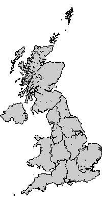
Geography: UK Government Office Regions (1999-)
Digital boundary data: This work is based on data provided with the support of the ESRC and JISC and uses boundary material which is copyright of the Crown, the Post Office* and the ED-LINE Consortium
Geography consists of 12 areas.
Available label styles
- GOR name
(e.g:North East,North West,Yorkshire and The Humber) - GOR code
(e.g:A,B,D)
[Generate list of all labels]Relationship to other geographies - defined hierarchies
- 2001 Census hierarchy
12 UK Government Office Regions (1999-)
= 426 UK interaction data districts 2001
= 10608 UK interaction data wards 2001
= 223060 UK Output Areas 2001
Relationship to other geographies - aggregation
- UK Government Office Regions (1999-) can be constructed out of:
- UK Government Office Regions (1999-) can be aggregated into:
- United Kingdom - member countries
- Great Britain and Northern Ireland
- UK North and South Geography
- United Kingdom